Grand Canyon to Utah

TOUR DESCRIPTION
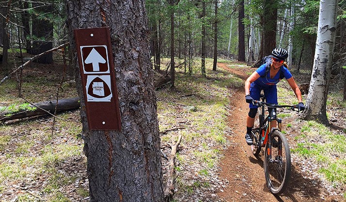
Receive Full ItineraryOne of Arizona’s least visited natural wonders lies hidden on the Kaibab Plateau north of Grand Canyon National Park. Along the Arizona Trail between Grand Canyon and the Utah state line you’ll discover outstanding singletrack, phenomenal views, and beautiful forests and meadows that seldom see human visitors. This area is only accessible between May and November as winter can bury the entire plateau in snow for over half the year.
This was the first segment of Arizona Trail to be designated in the 1980s and remains one of the most significant portions of trail in the state. After four days of riding you’ll understand why. While the first two days include rolling terrain at high elevation, the last two are mostly downhill. The highpoint of this ride on Day 1 is above 9,150 ft. and the lowpoint on day 4 is at 5,000 feet. Riders of all ability levels will appreciate this AZT Expedition, including beginners who don’t mind sucking a little wind at altitude.
Arrival day
Our meeting point for this trip is Flagstaff, AZ at Flag Bike Revolution. The day before the trip starts you can pick up a cooler (if needed) from us to do your shopping for the week.
Day 1:
Our first day we’ll meet at 7:00am at Flag Bike Revolution. This ride begins as dramatically as it ends, and before you climb aboard your bike and begin riding north you’ll want to take a short walk down the North Kaibab Trail and see one of the seven natural wonders of the world from its most spectacular vantagepoint. Peering into Bright Angel Canyon from the North Rim might be one of the best views in the world, but it’s only one of three unforgettable viewpoints you’ll experience over the next four days. The first ten miles of this day’s ride gain over 1,000 feet in elevation, which is no easy task considering you start above 8,000 feet. The trail rises and falls (but mostly rises) in and out of small drainages before entering the Kaibab National Forest. We’ll make camp here and allow you to catch your breath for the next day. Ride length is 13 miles.
Day 2:
The 21 miles you’ll cover today are considered one of the Top 10 passages on the entire Arizona Trail. The trail is filled with short and exciting challenges, but mostly consists of quality tread through thick sub-alpine forest. Spruce, aspen and fir trees obscure your view for most of the morning. That is, until you approach the East Rim View. This will stop you in your tracks and beckon you to ditch your bike for a while and soak up the scene. From this viewpoint you gaze out across Saddle Mountain Wilderness, Marble Canyon, Vermilion Cliffs and Navajo Mountain in the distance. It’s absolutely stunning. Once you’re back in the saddle the trail just keeps getting better as you pass Dog Lake and the lush open meadows of Tater Canyon. Riding through here is the stuff of dreams, and you’re unlikely to see any other people. The trail continues to climb and descend through minor canyons until you pass Crane Lake and approach our camp near Telephone Hill. Ride length is 21 miles.
Day 3:
Today begins the long, slow descent toward Utah. You’ll lose 1,200 feet over 14 miles across pleasant terrain. Porcupines and peregrine falcons have been seen here, and the only time you’ll have to get off your bike will be to hop over trees that have fallen over the past few months. It’s an opportunity to pedal, coast, smile, and repeat. The day ends near the tiny town of Jacob Lake, famous for its cookies baked fresh daily. Deer outnumber people here 1,000 to 1, and since mountain lions like deer you can count on sharing the forest with a few big cats. Although you’ll probably never see them, look for scat and tracks on the trail. Ride length is 17 miles.
Day 4:
The last two passages of the Arizona Trail are combined into one grand finale on today’s ride. Starting at 7,500 feet and ending at 5,000, just let gravity have its way with you and enjoy the ride. These 28 miles will disappear all too quickly under your wheels as you speed through the forest like a Jedi. After a few hours the terrain changes almost instantly as you leave the forest and enter a sea of sagebrush. The sweet pungent smell announces your arrival into a whole new zone. From here, the soil changes from grey-brown to red – hinting at the sandstone paradise that lies to the north. After crossing Winter Road, the Arizona Trail continues down down down on a segment of trail that you’ll want to ride over and over again. After cresting one small rise you’ll catch your first glimpse of Coyote Buttes, Buckskin Gulch and the sandstone domes of southern Utah. We have yet to meet anyone that doesn’t gasp from the beauty. You’ll spend more time on your brakes than your pedals as you coast into the State Line Campground at the border of Arizona and Utah – the northern terminus of the Arizona National Scenic Trail. Ride length is about 28 miles.
What’s Included in My Trip?
> Shuttle Van and driver
> Luggage, gear and cooler/food relocation
> Ready Camp kitchen and general gear
Not Included
> Alcoholic Beverages – we can haul and keep them cold though!
> Lodging
> Breakfast, Lunch or Dinner
> Weather Control – Mother Nature has a mind of her own
> Bikes


